

ABOUT COMPANY
Welcome To PV Infratech
PV Infratech is a trusted land surveying and mapping company dedicated to delivering accurate, reliable, and technology-driven solutions. With a team of skilled professionals and advanced equipment, we ensure precision in every project—from land surveys to GIS mapping.
We support property owners, builders, and businesses with detailed insights that help in planning, development, and decision-making. Our commitment to quality, transparency, and timely delivery makes us a dependable partner across India.
Precision today builds
the foundation of tomorrow.
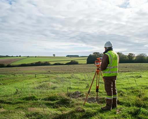
Our Proven Project Workflow
Precision-driven steps from site analysis to final survey delivery
-
 01
01Reach out and tell us your idea
We take emails, phone calls, messages, everything! If you are unsure of what's possible we are happy to advise, the most important thing is to get in touch. We'll be happy to answer any questions you may have. -
02
Start at the end
With drones, it's best to begin where you want to end up. What sort of deliverable would you like when it's all finished? If you are not sure then we can advise. We can look at what you would like and work backwards from there. -
03
Scope of work and set a price
Once we have agreed on what is to be done, the scope of work is set and a price is agreed upon. We feel it is vital that everyone knows what they are getting and what they are paying for it. There should be no confusion. -
04
Permits and other paperwork
Once we have confirmation you are happy to proceed, we start the ball rolling. We organise things like RAMS, site permits, Air Traffic Control clearance and much more. Basically, we generate everything needed to turn up on-site with all our ducks in a row. -
05
Field Operations
Next, we do the work on site. We have the gear, we have the know-how, so now it's time to get the job done. This can sometimes be affected by the weather, but for the most part, we get the job done on the date specified. -
06
Post Processing
This is where we take what we generated in the field and turn it into a final deliverable for you. This can be anything from the raw data itself, to fully processed Orthophotos, condition reports, CAD line work or thermal imagery. -
07
Handover
The final step is the handover of the deliverables. We tend to use a cloud-based service, so you can access your data anywhere. We can also tie into your existing systems if that is more convenient.
ABOUT SERVICES
Our Surveying Solutions
Core Land Surveying Methods
These are the "bread and butter" of the industry, focusing on high-precision measurements of the Earth's surface.
Advanced Aerial & Mapping Tech
Modern surveys are moving away from the ground and into the air for speed and scale.
Specialized Industry Survey
These surveys are tailored to specific sectors like construction, mining, and infrastructure.
OUR CLIENTS
Our Trusted Big Clients!


WHY CHOOSE US
Precision. Trust. Nationwide Reach.
Delivering reliable surveying & mapping services with speed and accuracy across India.
Licensed Professionals
Work with government-certified surveyors ensuring legal compliance and accurate results for every project.
Transparent Pricing
No surprises. Get clear, upfront quotes with zero hidden charges.
Fast Turnaround
Quick surveyor deployment and on-time report delivery to keep your projects moving.
Detailed Reports
Receive high-precision reports in PDF & CAD formats for legal, construction, and documentation needs.
Pan India Service
Serving metro cities to rural locations, we provide seamless coverage across India.
Trusted by Thousands
Preferred by property owners, builders, and developers for consistent quality and reliability.
Talk to us?